Specialists carry out expeditions on the Amazon River with the aim of collecting data in order to identify the level of the river and the possibility of water flow. The data collected in this expedition will serve as a basis for the information that has already been taken through satellites belonging to the French Space Agency and NASA. With this, it will be possible to improve the suspicion of flooding in the region, especially between the states of Amapá and Pará.
The research is the result of a partnership between the Mineral Resources Research Company (CPRM) and the French Research Institute for Development (IRD). The scientific tour that left Santarém (PA) to Santana (PA), started on January 29, 2020 and has 10 researchers from CPRM, IRD, Federal University of Western Pará (UFOPA) and Institute of Scientific and Technological Research of the State of Amapá (IEPA).
The information in this study was extracted from images taken by the satellites ICESat-2, SENTINEL-3 and JASON-3 over the Amazon Basin. In addition, the Brazilian states that comprise this basin (considered the largest hydrographic basin in the world) are:
- Amazonas,
- Acre,
- Roraima,
- Rondônia,
- Mato Grosso,
- Pará,
- Amapá.
The causes of flooding on the banks of the Amazon River
According to a study published in the journal Science Advances, the floods are linked to the increase in Walker circulation, that is, a kind of air circulation carried by the ocean originating from the variations in temperatures and atmospheric pressure over the tropical Atlantic and Pacific oceans.
Scientist Jochen Schöngart of the National Institute for Research in the Amazon (INPA) asserts: “This warming of the Atlantic and simultaneously cooling of the Pacific has resulted in increased flooding in the world’s largest hydrographic basin.” It is worth mentioning that this research is the result of an international workshop that took place at the University of Leeds (United Kingdom), at INPA, in January 2016, in order to address climate and hydrology changes in the Amazon Basin.
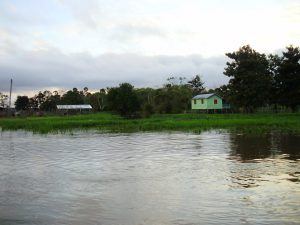
The data obtained in these studies serve as a parameter for government officials to adopt public prevention policies aimed at the region that may suffer from a possible flood. With the adoption of public policies, it is possible to avoid impacts on the lives of the population affected by these severe floods.
Impacts are generally:
- Loss of housing;
- Diseases;
- Lack of drinking water;
- Losses in livestock and agriculture
Amazon Basin
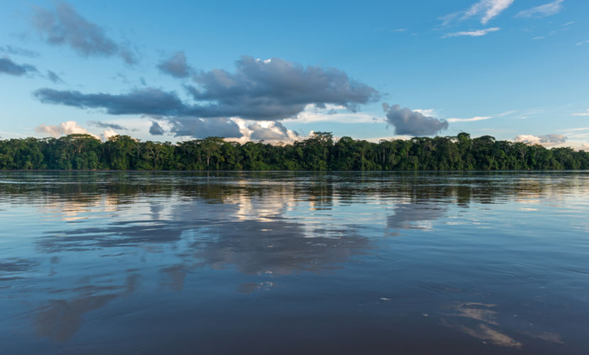
The Amazon Basin is considered the largest in Brazil and also on the planet. It consists of rivers, streams, streams and other tributaries that flow into the Amazon River. As it is the largest hydrographic basin in the world, this basin does not only comprise the Brazilian territory, but parts of Peru, Colombia, Ecuador, Venezuela and Bolivia, thus totaling approximately 3.8 million km².
The Amazon is the main river in this basin, being considered the second largest river in the world (it is second only to the Nile). It originates in the Andes (Peru) and, when entering Brazil, is nicknamed Solimões. The meeting between Rio Solimões and Rio Negro originates the Amazon River.
The Amazon Basin is considered to have enormous potential for producing electricity. In addition, another advantage is the possibility of using river transport, since its topography is flat and most of its rivers are flowy, that is, rivers with a large volume of water. For this reason, waterway transport is considered one of the main means of communication in this region.
Finally, it denotes the importance of the Amazon River Basin for the subsistence of countless riverside families who live off fishing. Undoubtedly, the Amazon River Basin bears fruit in this Region, given its importance for Brazil and even for the globe.
Amazon river
The Amazon River is the second largest river on the planet, totaling about 6.4 kilometers in length. It only loses in length to the Nile River, which is about 7,400 kilometers long. On the other hand, the Amazon River has the highest water flow in the world. Its source is located on Lake Lauri, in the Peruvian Andes.
At birth, the Amazon River is called Vilcanota and, afterwards, receives the names of:
- Uicaili;
- Urubamba;
- Marañón.
When crossing the Brazilian borders, it becomes Rio Solimões until the confluence with Rio Negro, near the capital Manaus. After this stretch, until the mouth, it is called Amazonas. In the Brazilian territory, the Amazon River falls from an altitude of about 80 meters, in the municipality of Benjamin Constant, reaching the ocean, after a course of approximately 3,165 kilometers. Because it suffers with only a difference of 80 meters, this river is considered an excellent stronghold for navigation (it receives ships from its mouth, in the city of Belém to Manaus).
At the meeting of the Negro and Solimões rivers there is a beautiful landscape, since the waters of these rivers have different colors. The first has the darkest waters, due to the dissolution of humic acid. The second, on the other hand, has clear waters and, therefore, when they meet, the waters do not mix.
Another important factor concerning the Amazon River is the phenomenon known as “pororoca” (a term originally from Tupi that designates a crash). This corresponds to the formation of waves arising from the abrupt encounter of the waters of the river with the Atlantic Ocean. In general, this phenomenon is evidenced in the changes of the phases of the Moon, more precisely in the phases of nova and flood, in the month of October, because, in this period, the level of the river is low and the high tide.
Therefore, the phenomenon occurs at a time when the water levels from the ocean are higher and invade the mouth of the river. This invasion results in the emergence of large waves that reach approximately 10 meters in width and 5 meters in height, totaling a speed of approximately 35 kilometers per hour. Furthermore, in addition to the natural spectacle that the meeting of the waters promotes, one can also speak of the destruction on the banks of the river that results in the fall of many trees (even large trees).