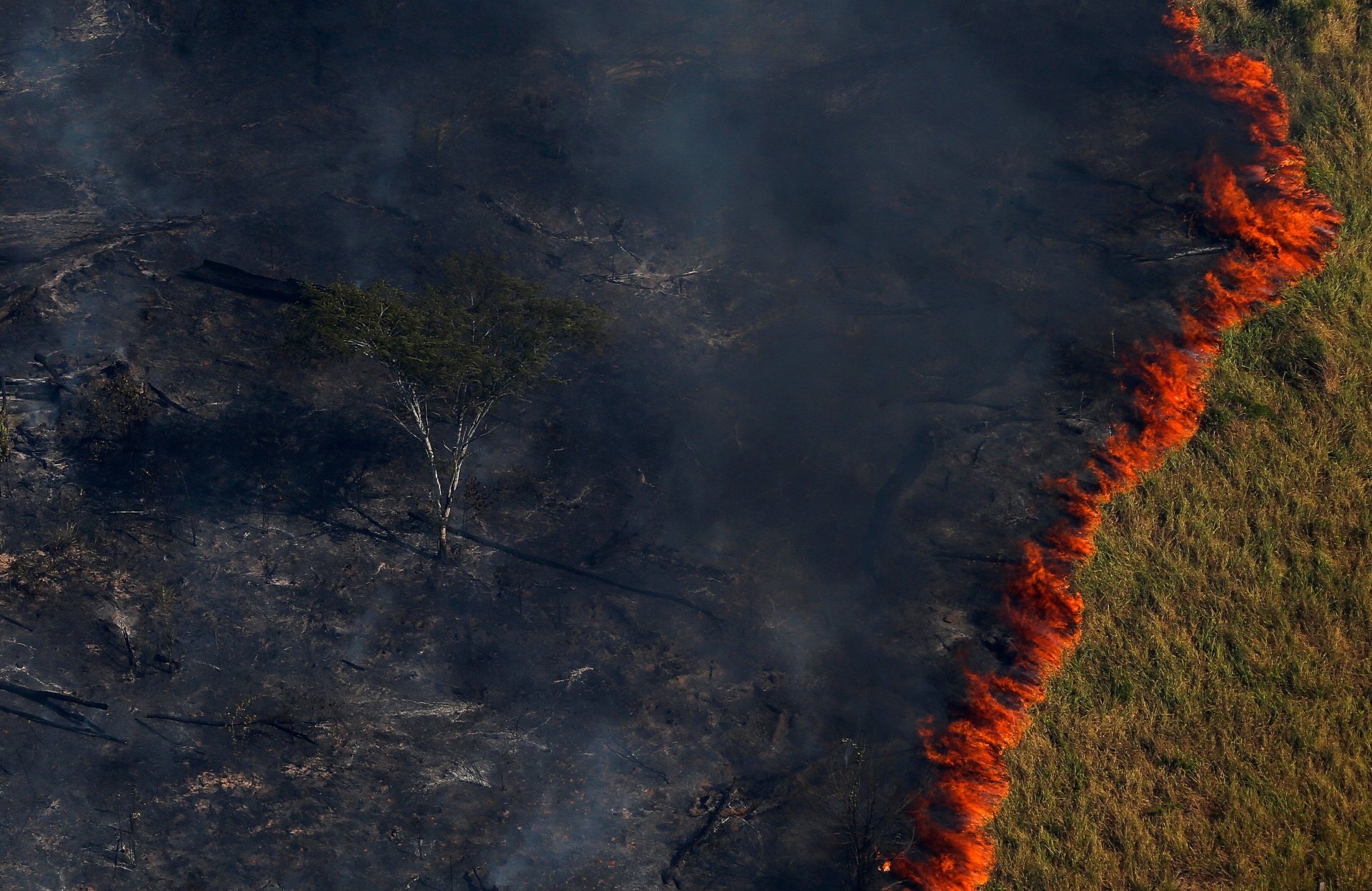
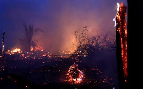
The state of Rondônia, located in the northern region of Brazil, shows a drastic increase in the number of fires. Compared to the period of the first five months of the previous year, 2020 shows an increase of almost 40%.
A fire area is understood to mean an area on fire that is at least 30 meters long by 1 wide, a measure necessary for the location to be detected by satellites.
The increase causes the state to move to 15th position among those with the largest number of outbreaks throughout Brazil.
More details on the almost 40% increase
In 2019, the National Institute for Space Research (INPE) recorded 155 active fires in the state of Rondônia. This survey was carried out from January to May.
The same period in 2020 shows a significant increase in the number of outbreaks. In relation to the 155 registered in the previous year, there are currently 56 new outbreaks.
This means that, in the first 5 months of this year, the region reached 211 focus.
This increase of 36% is pointed out by experts as an alarming fact.
How fire outbreaks are identified and verified
The verification of fire outbreaks carried out by INPE is supported by the population through voluntary observations.
If an individual perceives the occurrence of fires in any vegetation (be it pasture, forest, plantation or any other type), he can report what happened to the institute through a channel developed exclusively for this purpose.
For the realization of registration, the citizen can send the data collected to the Queimadas Program, developed by the agency. The main information to be presented by the observer is:
• Latitude; • Longitude; • Time when the fire was observed.
It is also possible to enter other additional information if the observer has it, such as characteristics and category of the fire.
After receiving this data, the institute’s program sends the case for validation. At that moment, the indications of hot spots registered by satellites are used.
That is, the coverage provided by the satellites is directed in relation to the coordinates indicated by the event observer so that the process becomes as objective and precise as possible.
Monitoring the evolution of the number of outbreaks
As already mentioned, the Program has 211 active outbreaks notified until May 28, 2020. Within this total number of outbreaks, it is interesting to observe the evolution that occurred between the analyzed months.
In January 2020, 56 outbreaks were notified. This was the month with the worst index of the year so far. In comparison with the same month in the previous year, there was an increase of 23 outbreaks.
From January to February, there was a good reduction, increasing the number of new outbreaks to 39. This number showed a slight reduction until the month of April, which presented 33 new outbreaks.
In May, the quantity increased again, indicating a significant increase. In May 2020, 45 new fires were detected.
In some aspects, it can be said that the outbreak curve of the outbreaks was not very different from that presented in the previous year. However, what makes the current data even more alarming than that of 2019 is the large number of cases presented in the first months of the year 2020.
Understanding this data in the extent of deforested area
Due to the increase in fires, deforestation in the state presents a worrying rise. Experts draw on the region’s history of deforestation to help understand the case.
According to information detected by Mapbiomas, between the years 1990 and 2017,
Rondônia lost an area of forest that comprises 70,000 km².
Mapbiomas is an initiative of the Climate Observatory’s Greenhouse Gas Emissions Estimation System (SEEG / OC) produced through a collaborative network composed of Non-Governmental Organizations (NGOs), technology companies, and universities. Organized by biomes and cross-cutting themes, these institutions work to collect relevant data for the analysis of situations such as the one currently witnessed by the state of Rondônia.
The extent of the area devastated by the current fires has not yet been calculated, however, this history of the region illustrates the proportion of the damage that may be faced.
The state is marked by the constant growth of areas used as pasture for agricultural and / or livestock enterprises. 30 years ago, the state’s forest formation was just over 20 million hectares, having been reduced to 14 million hectares by 2017. In the same period, the amount of pasture grew by more than 200%, from 2,7 million hectares to almost 9 million.
The situation is also serious in other states
As already mentioned, Rondônia is among the 15 Brazilian states with the highest amount of fires. The state that occupies the first position in this list is Mato Grosso, which has already registered 4,500 new burning points this year.
The state is followed by Mato Grosso do Sul, with 2,155 focus, and Roraima, which has 1,651 focus.
The Amazon region has also shown worrying rates. According to data presented by INPE in January, fires at the site increased by 30% from 2018 to 2019. In 2018, the biome had registered 68,345 fires. The result, which was already alarming, became even worse the following year, reaching 89,176 focus.